Nos Passos do Património (In the Footsteps of Heritage)
Plan A was that this would be a very quick and dirty blog.....a starter photo of the usual culprits: Lto R : John, Peter, Julie, Karen, Jan, Geoff, Alan, Stephen, Susan,Bruce,Tony, Maggie,Steve, Sue...no dogs, a first?

followed by a walk description cribbed friom the PR15 website: " This circular route leaves from Vale Fuzeiros and reveals a valuable archaeological heritage (menhirs, necropolises), but also the villages and the red earth landscape of the Silves sandstone."
Or in more detail:
"The route starts in front of the "O Gralha" restaurant. It follows Estrada Municipal (EM) 1080 towards Barragem do Funcho for about 300 metres and then turns left onto Rua de Vale Fuzeiros. It keeps going for about 500 metres and then turns up towards the magnificent Monterrosso hill.Take a brief diversion to the right to visit the Pedreirinha necropolis. Return to the trail, which continues for about 1.5 kilometres until it reaches a tarmac road at the entrance to Amorosa. On the road, the route goes straight ahead along Rua 18 de Janeiro de 1934, then Rua do Trabalho and Rua da República. At the end of this street, it turns right and goes straight on towards Rua da Escola. At the crossroads, it turns left onto Rua Luís de Camões. The route crosses the EM 1079 and goes straight on. Then it turns right, along a citrus grove. It crosses the Barrada da Amorosa road and starts climbing. Before the tarmac road, take a break at the Fonte do Chafariz picnic area.
When the route reaches the National Road (EN) 124, it turns left and then goes right, up the dirt track. At the top, it turns left and, about 350 metres later, turns right. For about 1 kilometre, enjoy the wide views down to the sea. The path curves to the left and then turns right. At the crossroads, it turns right and then right again.
After about 600 metres, it turns right and goes straight on until it reaches the end of the cluster of houses. Then it turns left back to the EN 124; it turns left and then, after about 100 metres, right, in the direction of Monte Novo. At the fork, the route turns right and, once it reaches a cluster of houses, turns left along a narrow path. It goes straight on and, at the crossroads, turns left onto Rua da Fonte and then left onto Rua 5 de Outubro, along a narrow road. At the end of the climb, on the tarmac road, it turns right and then left along the path you've already taken. About 1.5 kilometres later, the route turns left. This next segment has a short steep incline.
From here you'll find the area's important archaeological heritage: menhirs, necropolises and graves. The path continues for about 1.7 kilometres along the top of the hill, where you'll find four menhirs . It goes down and turns right onto the tarmac road and then left along a dirt track. Then it turns right along a narrow track. It crosses a small watercourse and begins to climb. At the end of the climb, it turns right and goes straight around the hill. You'll see a small dam on the left. The route then meets the tarmac road, turns left and follows this road to the EM 1080. It turns left and then right along a narrow path that takes you to the Carrasqueira necropolis. The route takes the same path back to the EM 1080, turns left and follows the main road. After the "Vale Fuzeiros" sign, it turns left and continues to the end of the climb. It then turns right along Rua de Vale Fuzeiros.
At the crossroads, the route joins the GR13.12 - Connection 12 - Via Algarviana (Funcho) to Vale Fuzeiros for around 250 metres. It then turns left, passing the necropolis of Forneca, while Connection 12 continues straight ahead. At the crossroads, it turns right and then, on the EM 1080, turns right again, close to the finish."
Which was broadly correct, other than tarmac was confused with cobbled and "crossroads" sometimes needed a liberal interpration....anyway, we started at the Silva cafe rather than the O Gralha ( closed on wednesaday) , and otherwise followed the plan ( well, all apart from the mutineers, see later) , though some of the turnings could have been better marked...or marked at all even. Anyway, on to plan B.
The weather of late has not been very Algarvian...in fact the forecast was for " torrential rain and thunder in afternoon) , but only 2 decided not to risk it, so 14 set off after our coffee, though Sue didn't seem to enjoy the company of the cafe doggie...

The first necropolis....no one wanted to try the graves for size...


Thence up into the hills and on to Amarosa...admiring the wildlife...


what did we say about not straggling?....where are they?

Up to the Fontes for a banana break...


Over the N124 through Monte Boi....and a man in a hole...

and into the orange and avocado orchards..


As indeed it did en route back through Amarosa...


Someone didn't want us to go that way...

but that was a mere drizzle...Bruce decided he would have a go at another well...

...before it was pointed out that it had been welded inoperable...so we turned up to the menhirs...


But we must have angered the rain gods with our flippancy, as the heavens decided it was time to soak us...

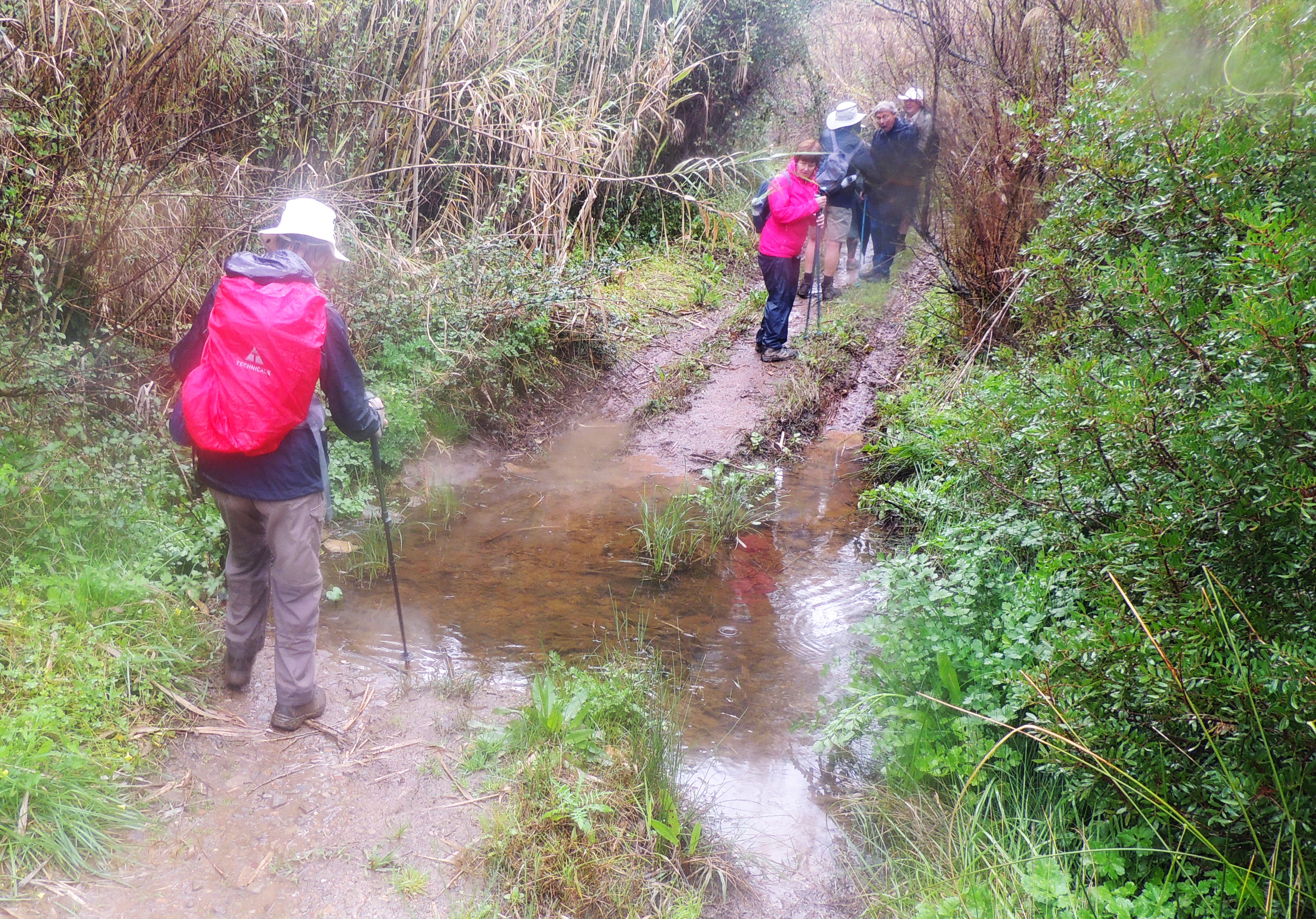
Those made of sterner stuff forded the stream with some ease....


....before getting back to the Silva and attempting to dry off and shaming the 7 MUTINEERS...

They had better remain anonymous, but 6 of them are here!
My phone decided to play up, but here is the official map :


The official version equates to 3kph....we did it in about 4h40m and Peter reckoned it was 17.1kms which is about 4kph allowing for a brief lunch.
Thanks to all those who braved the weather and still ended up smiling.....and to alan for many of the photos.
Geoff
In a way I was glad I cried off but looked a lot of fun. Look forward to a drier version next time.
ReplyDeleteWhat great fun and the mutineers are the dry ones!!! Not too sure about the fashionista!!
ReplyDelete