Monday 31 May 2021

Hiking to the "Swing Bridge" in Pukaskwa Nation Park, ON, CA

Although staying fit plays a major role in our retirement plan, our motivation for adding posts to the AWW Blog is to show those that have never visited Canada what a beautiful country it is. At least as it pertains to our neck of the woods! 

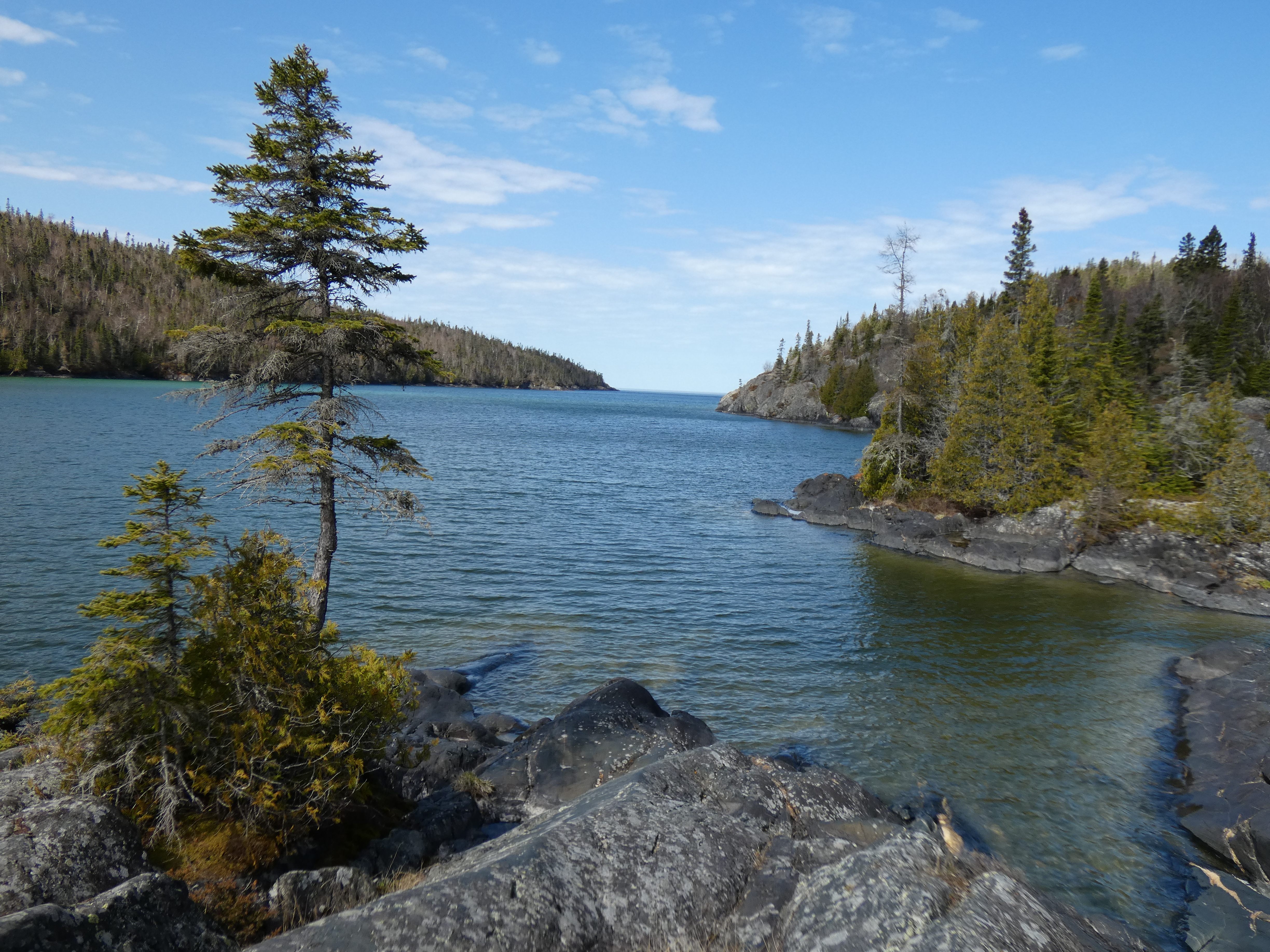
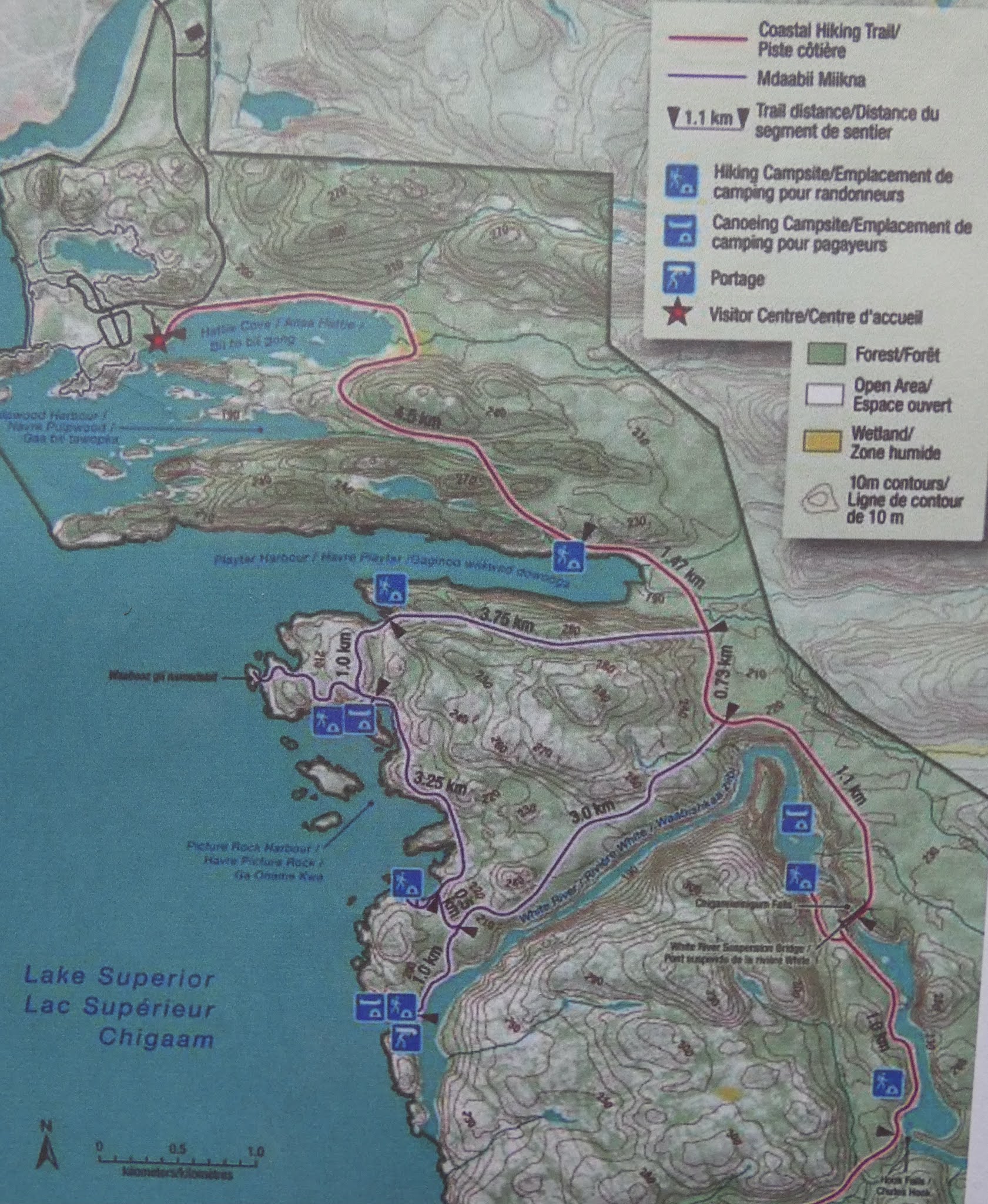
May 13, 2021  - Cool sunny weather and still no mosquitos made for the perfect conditions for hiking in Pukaskwa National Park, which is located @ 30km from our home. This hike to the "Swing Bridge" is one of the hardest hikes in the area but the scenery makes it worth the effort. 


Pukaskwa National Park covers an area of 1878 square km and hunting is prohibited, so wildlife flourishes. This wild rabbit is out to feed on the fresh green grass.


Trudy standing beside a metal statue depicting the average size of a cow moose (female)


9:00 am start from Hattie Cove (Lake Superior). Temperature of 4C


A tall Poplar tree (15" in diameter) gnawed down by eager beavers in order to access the smaller branches at the top. I included my walking stick as a scale. 


The beavers' home!


The following photos shows the terrain for the 1st half of the hike. Very rocky, making walking slow and tiring.


5 km and 2 hrs later, we arrive at the halfway point - Playter Harbour (Lake Superior). Excellent time for a short rest and a snack. Temperature now 10C... Sunscreen!?


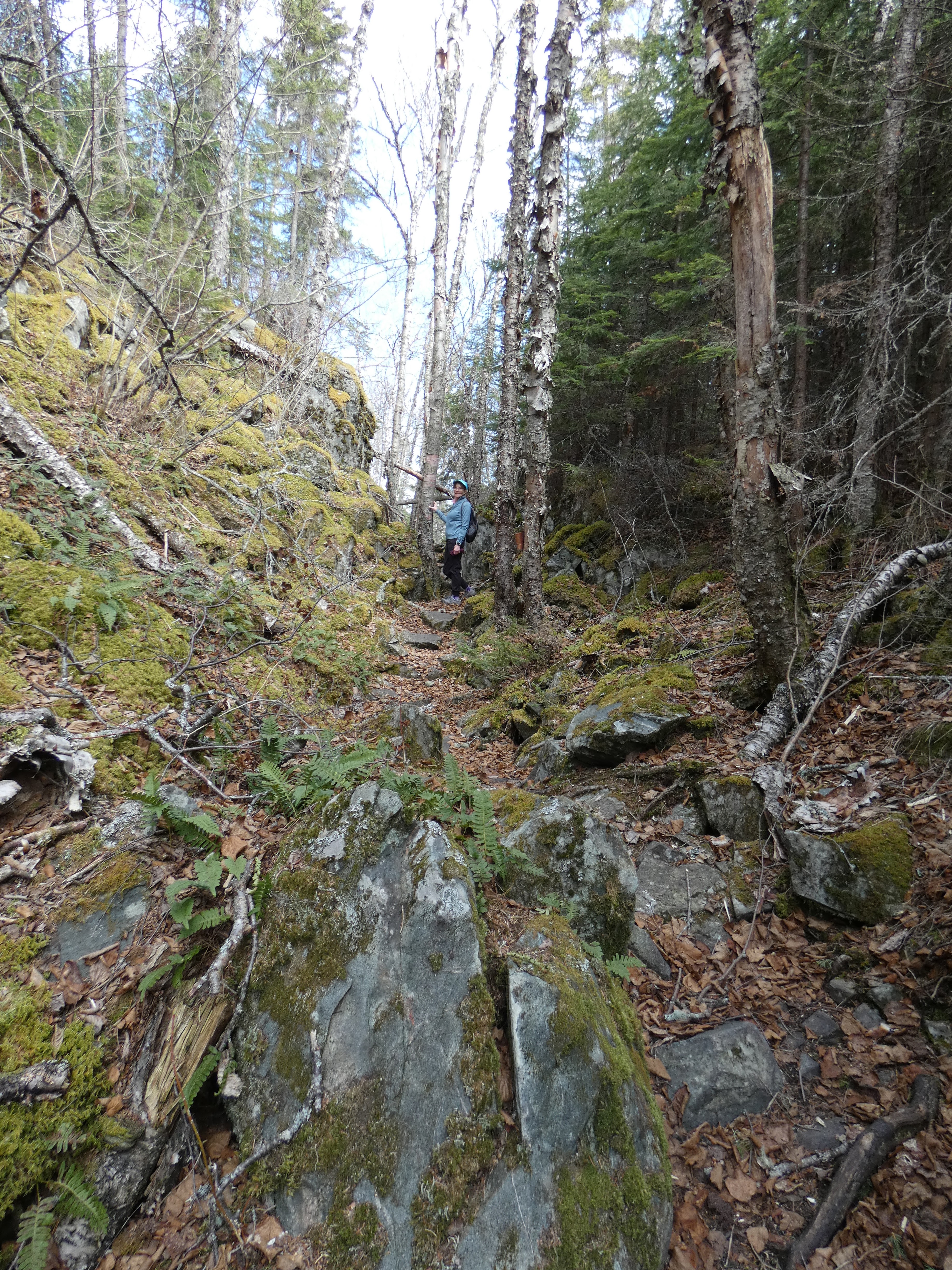
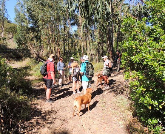
The trail improves and we are able to pick up the pace.


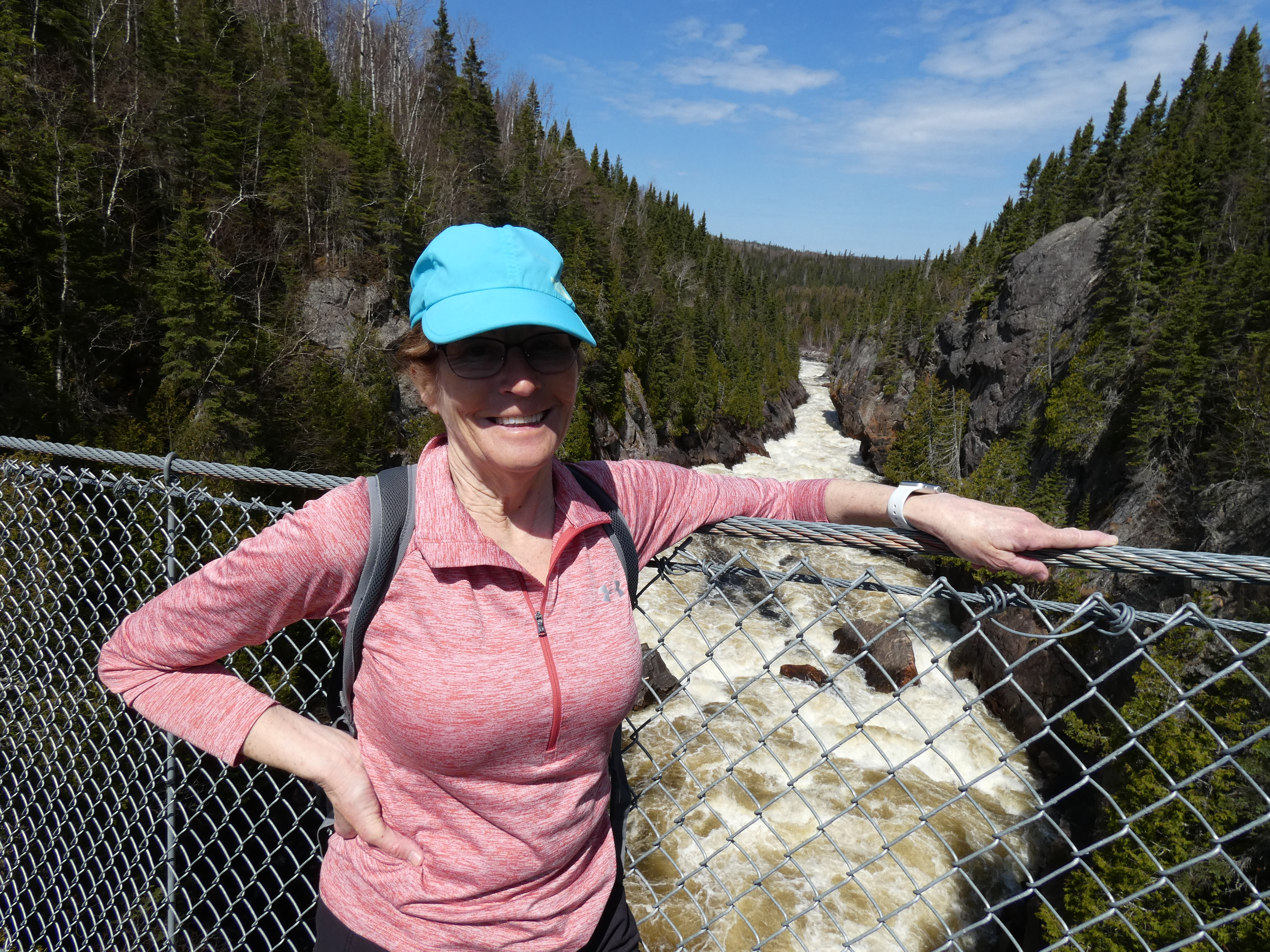
The Swing Bridge, which spans across the White River, which in turn flows into Lake Superior. The Bridge was rebuilt a couple of yrs ago, making it more sturdy and safe. The original bridge was much more "flimsy" and would swing from side to side as you walked across, thus the name. Many hikers would make it to the bridge but refused to cross it for fear of falling.


Fast flowing waters of the White River (view from the bridge)


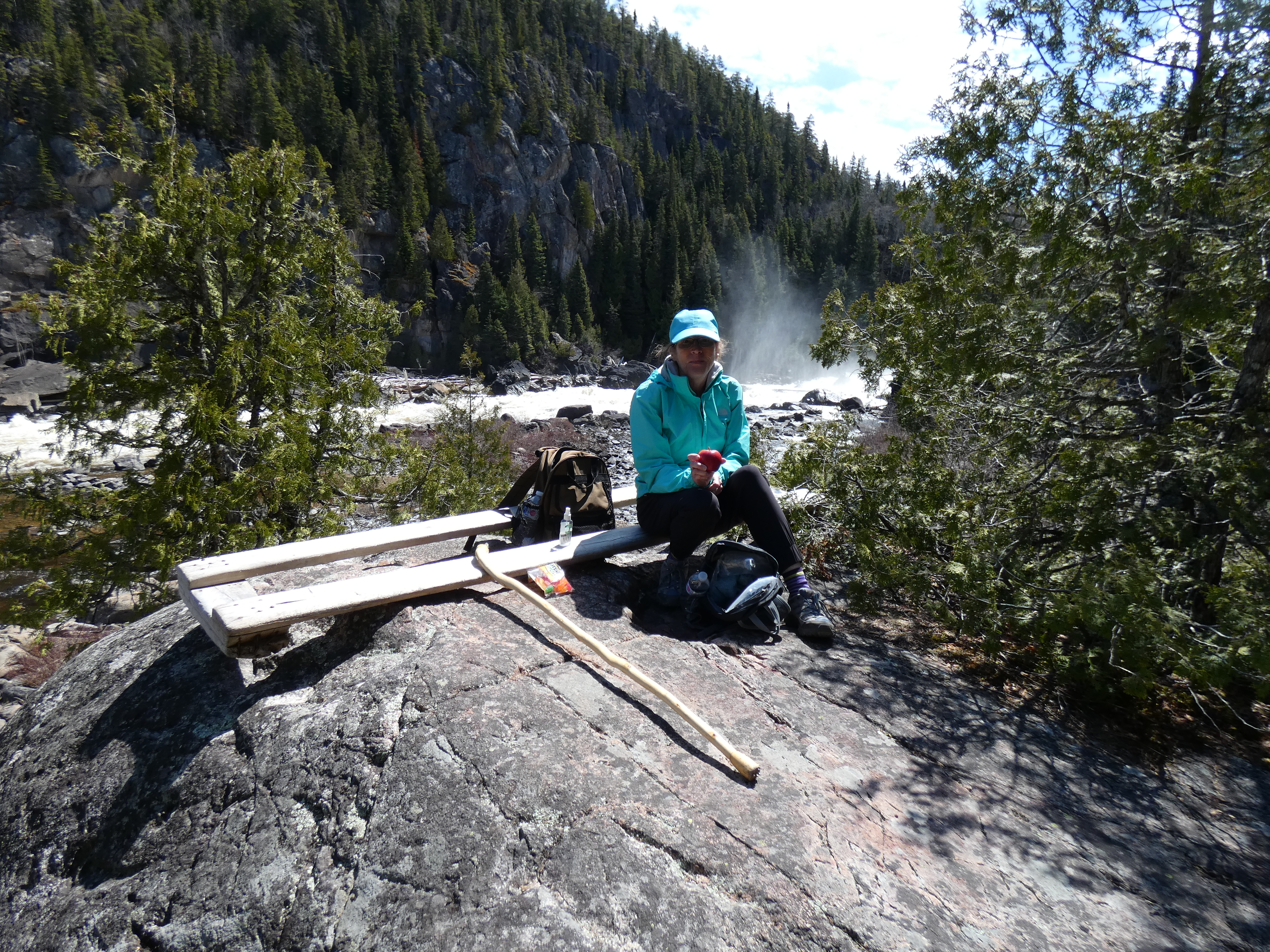
We then carried on for another km to see Hook Falls. Unfortunately the rocky terrain would not allow us to take a better photo of the falls.


Top end of the falls. That's as close as Trudy would allow me get. Falling into the water would not have had a happy ending!


A well deserved lunch before the return trek.


The "red" line is the trail we hiked. 


Stay tuned for further posts as we head into the month of June and the start of our kayaking season.

Friday 21 May 2021

13 go walking in the heat of the day

 AWW 19/5/21


14 AWW’s and 3 dogs assembled at the Tesouros da Serra café in Tesoureiro, near Alportel, for the customery team photo. From left to right: Ken, Frank, Miriam, Martin, Sue, Jan, Sergio, Dave, Karen, Roger, David, Brenda and Alan with Bica, Rafa and Mamas. 

We started earlier than normal at 9am as the temperatures were forecast to be in the 30s.  From the café we headed off down to the Ribeira Algibre where there was still plenty of water and it would prove to be very welcome as the day wore on.
 
Chatting as always!

Fancy a game of chase?


After the cool of the river, we headed on up into the hills followed by a steep downhill back down to another river valley where yet again we took advantage of the shade.
The views from the top made the long slow slog uphill  worth while and there was a great breeze that kept us reasonably cool.


Talk about the women chatting - not as much as the three musketeers who talked the whole way up the hill.

Lunch was taken in the hunters meeting place.  At least there was shade and somewhere to sit.  Brenda made sure the dogs had their lunch too!


After lunch it was downhill all the back down to the river valley where a deep water crossing suddenly became a place to throw caution (and bin liners) to the wind.


And then we walked back along the river valley. By now it was getting quite hot and the breeze had dropped. 


Finally back to the cafe where we were looking forward to cold beers and wine.  No wine, only small Cristal beer, no Coke Zero!! 


16.6 km, elevation of 470m. Temperature 31degrees!!
Time 4.5/5 hours.


Thursday 20 May 2021

AWW Fonte Ferrea Wednesday 12th May 2021


AWW Fonte Ferrea Wednesday 12th May 2021


Finally with most of the Covid-19 restrictions removed a good turnout of 12 hardy hikers arrived in Fonte Ferrea (just north of Alportel) on a cloudy but warm morning on May 12th.  

Our group from left included:


Sergio, Alan, Jan, Sue, Dave, David, Frank, Miriam, Ken, Brenda, Ros, myself and our three canine friends.

With an on time start we climbed up the first of s series of hills to begin a sequence of ridge routes and some great views:


It was shortly later that in what Sue would describe as deserved hubris I quite literally fell on my ass on a downhill stretch. Undeterred we carried on : 

As the morning began to heat up it was on the longest toughest hill that one of our crew decided to lighten his load and abandon his smartphone. Quickly spotting this only at the very top of the hill a pair of our extreme athletes volunteered to descend the hill and recover it. 

The rest of the group carried on to reach the miradouro at Alta da Ameixeira for a well deserved pit  stop and some detailed instructions from Jan:
 

to which Ken and Miriam paid close attention:


The views and colours up here were lovely:


 We then began a long slow descent with an opportunity to admire the local flora:


We had hardly arrived at our chosen lunch stop when our extreme athletes Dave and Sergio arrived with the recovered smartphone.


As usual Sue had some doggie treats much appreciated by Bica and Rafa:


Before we set off after lunch Dave treated us to his "The Rock" impression:


With a couple of water crossings and some local village scenes we soon reached our final stop in Cafe Avalanche:

                                                                             cork oak


Cafe Avalanche and a well deserved drink:


Thanks to everyone for some great chat. Special thanks to Dave and Sergio for recovering the phone. Thanks to Alan for his photos as usual and also thanks to Roger whose route I stole.

Total distance about 15.2km.
Route details: